How GIS Can Improve Your Lead Service Line Inventory and Capture Project Funding
Lead is present in municipal water pipes throughout New York and the entire country, but technology is making safe water possible faster.
Podcast: Tracking Community Assets with GIS
Imagine a tool that tracks any feature in your community—whether that’s a lead waterline, a tree, a fire hydrant, or a building. What might that mean for your community? How much better could you plan for development or budget for improvements? What if, with the click of a button, that tool could help you communicate better with residents, secure funding, or share knowledge with a successor? What if that tool already exists and it’s affordable?
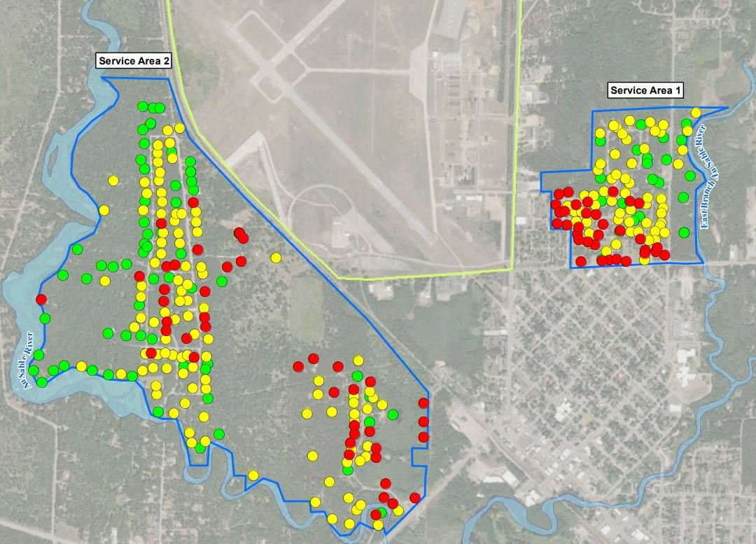
Addressing PFAS in Grayling
Clean water is top-of-mind for community leaders nationwide as we address the lasting effects of PFAS contamination. Now the community of Grayling Township, Michigan, is working to address contaminated groundwater due to fire-suppressing chemicals from a nearby Air National Guard base.


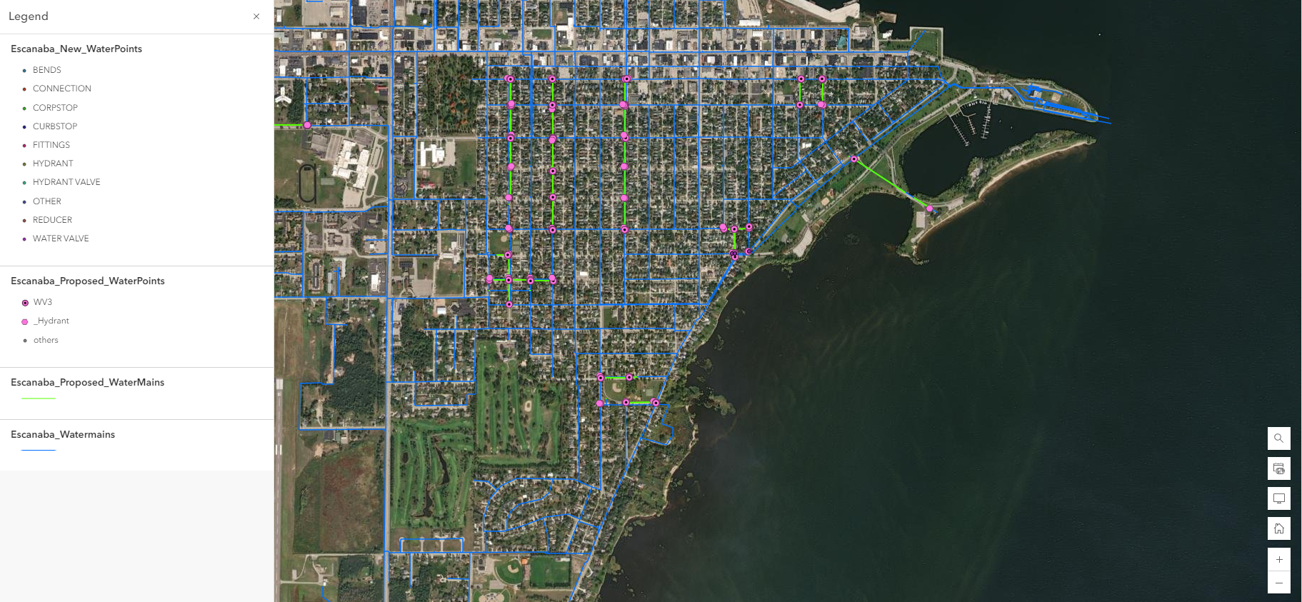
Avoid Emergency Repairs: Manage Your Town’s Assets With GIS
Your town relies on a network of inter-related assets. Maybe you have a good idea of what condition some of these assets are in, but how do you effectively communicate that knowledge to others? How do you prioritize which assets to spend money on this year versus next? Which asset is closest to failure?